
The global transition towards renewable
energy is accelerating, with solar power playing an increasingly important role
in achieving a low-carbon future. However, the expansion of large-scale solar
power plants raises an important question: Can we generate clean energy
without compromising the natural environment?
Solar developments often require extensive
land areas that may overlap with agricultural fields, wetlands, natural
vegetation, drainage networks, and ecologically sensitive habitats. Balancing
energy generation with environmental conservation requires a comprehensive
understanding of the landscape. Geographic Information Systems (GIS), Remote
Sensing (RS), and spatial modelling offer integrated approaches to achieving
this balance.
1. Agrivoltaics:
Integrating Agriculture and Solar Energy
Agrivoltaics combines solar photovoltaic
panels with agricultural activities on the same land, allowing crops to grow
beneath or between appropriately designed installations.
GIS and remote sensing support this
approach through land-use and land-cover (LULC) mapping, soil suitability
assessment, solar radiation modelling, and agricultural productivity analysis.
Satellite-derived vegetation indices, such as the Normalized Difference
Vegetation Index (NDVI), help monitor vegetation conditions and seasonal crop
patterns. Digital Elevation Models (DEMs) further support terrain analysis and
site suitability assessment, identifying opportunities for dual land use.
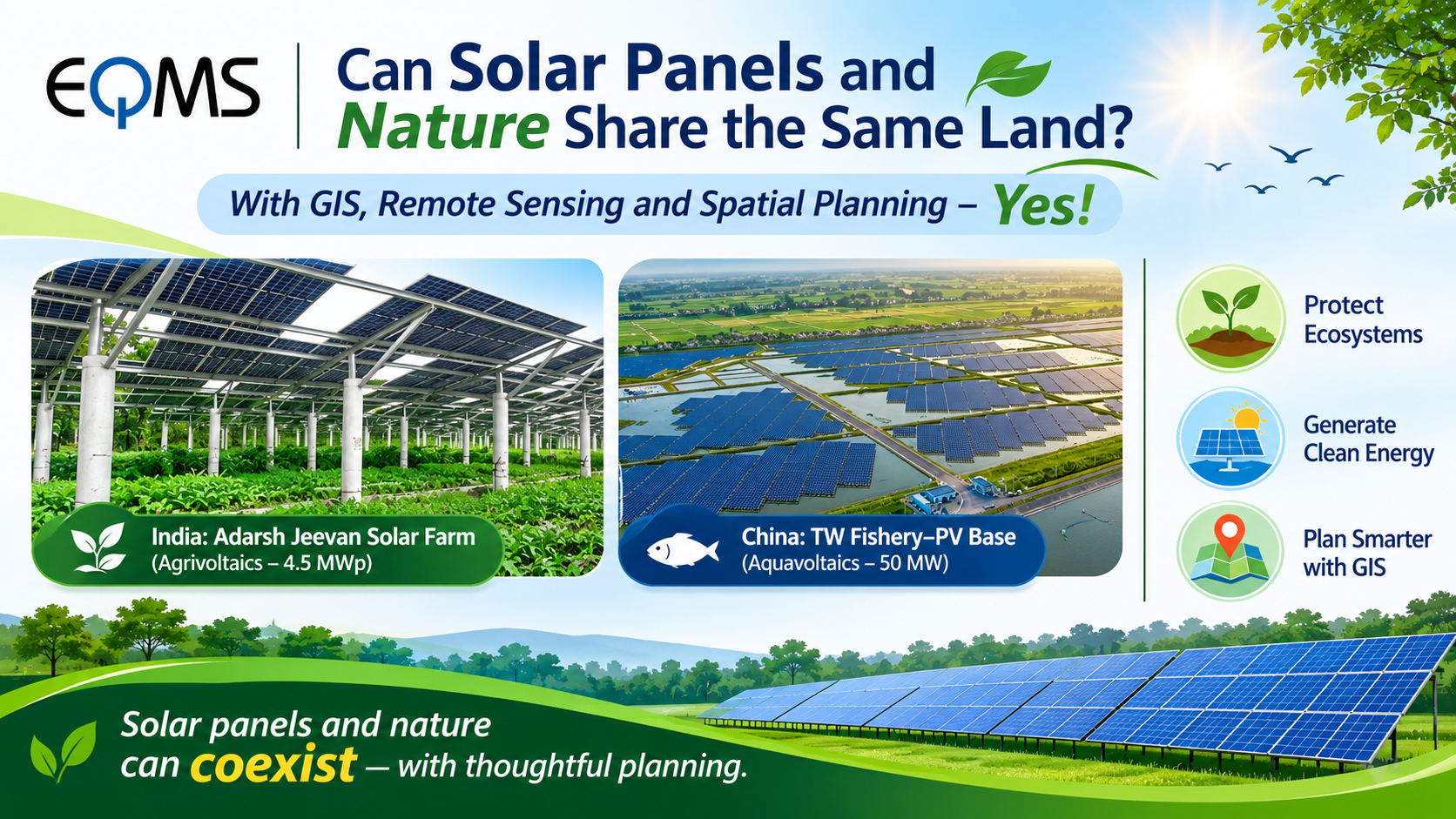
Case Study – India: Adarsh Jeevan Solar Farm (4.5 MWp) in Madhya Pradesh integrates
elevated solar panels with crop cultivation across 16 acres, demonstrating how
solar energy generation and agriculture can coexist while enhancing farmer
income.
2. Aquavoltaics:
Exploring Solar Potential on Water Surfaces
Aquavoltaics, commonly associated with
floating solar systems, involves installing photovoltaic panels on suitable
water bodies such as reservoirs, ponds, and artificial lakes.
Satellite imagery from Sentinel-2 and
Landsat can identify water surfaces using the Normalized Difference Water Index
(NDWI). Multi-temporal analysis helps monitor seasonal water-level variations.
GIS-based suitability modelling can combine waterbody boundaries,
accessibility, hydrological characteristics, and environmental sensitivity to
identify potential installation zones while considering aquatic biodiversity,
fishing activities, water quality, and community requirements.
Case Study – China:
The TW Fishery–PV Integration Base in Nanjing, Jiangsu, combines 50 MW of solar
power generation with aquaculture across approximately 146.67 hectares,
demonstrating the potential for simultaneous electricity generation and fish
farming through shared water-surface use.
3. Biodiversity,
Nature-Based Solutions and Spatial Planning
Solar farm development can fragment
natural habitats, disrupt wildlife movement, and alter drainage patterns
through vegetation clearance and land modification. GIS-based analysis of land
cover, habitats, and protected areas helps identify sensitive zones and
biodiversity corridors, while DEM-based hydrological analysis supports natural
drainage preservation and vegetation retention.
GIS integrates ecological, hydrological,
agricultural, and topographical data through Multi-Criteria Decision Analysis
(MCDA), environmental sensitivity mapping, and spatial suitability modelling.
These techniques help identify suitable solar development zones while
prioritizing wetland protection, native vegetation restoration, vegetated
buffer zones, and natural drainage channels. UAV surveys and satellite imagery
further support vegetation assessment and environmental monitoring throughout
the project lifecycle.
4. The Role of GIS:
Making Renewable Energy Nature-Friendly
GIS provides more than a tool for
identifying suitable solar development locations. It offers a scientific basis
for understanding landscapes, evaluating environmental constraints, comparing
development alternatives, and translating environmental priorities into
practical spatial designs.
The future of renewable energy should not be measured by electricity
generation alone, but also by how responsibly we use land, water, and natural
resources.
Solar panels and nature do not necessarily
have to compete for space. Through geospatial intelligence and thoughtful
spatial planning, renewable energy infrastructure can coexist with agricultural
landscapes, water resources, natural habitats, and ecological processes.
Share this page via
More from Farah Shamima Sultana